Land Boundary Survey
A drawing prepared of a sizeable tract of land showing all the elements of a Land Boundary, which may include improvements, easements, ownership deed lines, and other matters of concern for landowners, title companies and mortgage lenders.
Title (Mortgage) Survey
A residential survey showing the boundary lines, the improvements easements, building set back lines and restrictions for the purpose of satisfying a mortgage lender and /or title company.
Lot Staking
To locate and mark the boundary corners of a lot or tract usually for the knowledge of the owner and their use, such as constructing a fence, landscaping or creating drainage ways.

ALTA/NSPS Land Title Survey
A detailed survey requested by clients that are of specific importance to lenders, title companies and landowners. A certain list of items are to be selected from a “Table A” by the client, so the surveyor may create a survey based upon those selected items. Usually involves an out of state lender.
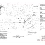
Subdivision Platting
A subdivision plat must be created when a landowner wishes to divide his property into two or more parts and either of the two parts are less than five acres (ten acres if located in a rural county area.) This plat must meet the subdivisions regulations for the local city and/or the County Commissioner’s Court.

Passage and Utility Easements
Where a landowner may wish to grant another landowner or utility provider an easement on their land for specific purposes. Sometimes special provisions may be needed. Consultation with a real estate attorney would be advised.
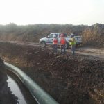
Design (Route) Survey for New Construction and Utility Easements
RCS provides Topographic Surveys for the use of the client and their design team to accomplish the purpose of new construction for a residence, a commercial project or a proposed short or long range utility line.
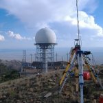
Cell Tower and Antenna with Directional Requirement
Layout of towers and antennas with specific requirements as to a certain bearing or azimuth either referenced to true or magnetic north.
FEMA Elevation Certificate
Provide elevation certificate as required by FEMA for property in a potential flood zone mainly used to satisfy insurance requirements.
Hydrographic Survey
Used to determine depths, volume and other statistics on ponds, rivers, streams and lakes.

Aerial Mapping Service (SUAS)
Certified by the FAA for drone services to include survey control and mapping by aerial and terrestrial topography.
GIS Mapping Service
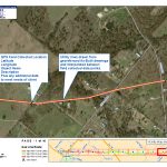
To obtain or update asset data collection and management. Overlay route surveys onto aerial imagery.

Construction Survey
RCS provides construction layout for residential, commercial and governmental clients. Projects include homes, buildings, parking, roads, highways, dams, reservoirs, transmission lines and many other projects.
REFERRALS
City of Waco
RCS have successfully completed numerous projects with a quality professionalism about their work and deliverables. They have consistently provided timely deliverables that have been within budget on all jobs. If you have need of a firm that is loyal, dedicated, truthful and upright in their relationship with the client, we recommend you acquire their services for surveying and mapping.
– Mark Hines, P.E., Director of Engineering City of Waco
Scott & White Healthcare
Ronald Carroll Surveyors, Inc. has become a true partner over the last several years, meeting all expectations and becoming our surveyor of choice for both large scale projects and routine tasks. They have shown a high level of competence and integrity, as well as the ability to respond quickly in order to meet aggressive schedules. Time and again, they have coordinated closely with both us and the architect, delivering quality products on time.
– Justin R. Johnson, Director, Design and Construction, Scott & White Healthcare
U.S. Department of Transportation
RCS has performed surveys for the Federal Aviation Administration (FAA) as required to ensure current, accurate land boundaries for FAA’s various air navigational aids located on leased/owned property. The metes and bounds legal descriptions to the facility site and varied types of easements under separate ownership are completed and certified in a timely manner.
– Jana C. Blanco, Real Estate Contracting Officer, Real Estate and Utilities Group, Central Logistic Service Area

